


Galtymore Horse shoe

mlmoroneybb
User
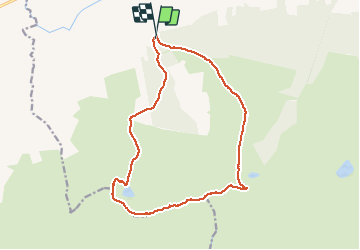

Length
13.7 km

Max alt
910 m

Uphill gradient
1016 m
Km-Effort
27 km

Min alt
138 m

Downhill gradient
1016 m
Boucle
Yes
Creation date :
2014-12-10 00:00:00.0
Updated on :
2014-12-10 00:00:00.0
--
Difficulty : Difficult

FREE GPS app for hiking
 SityTrail
IGN / Geographical institutes
SityTrail Plus
The world is yours!
About
Trail Via ferrata of 13.7 km to be discovered at Unknown, County Tipperary, The Municipal District of Cahir — Cashel. This trail is proposed by mlmoroneybb.
Description
Mountain Walk
Positioning
Country:
Ireland
Region :
Unknown
Department/Province :
County Tipperary
Municipality :
The Municipal District of Cahir — Cashel
Location:
Clonbeg
Start:(Dec)
Start:(UTM)
555406 ; 5805988 (29U) N.
Comments